PIX4D, DroneDeploy and DJI Terra are not single interchangeable processing engines. Before asking which is better, identify the specific products and the job you need to deliver. A desktop reconstruction licence, a hosted mapping service and a broader site documentation platform cover different scopes.
Owning a DJI drone does not settle the question either. The aircraft brand tells you little about where processing should run, who needs to open the result or which file the client expects at the end.
This comparison is written by the MapperTool team, so treat it as a test plan rather than a verdict. Vendor product information was checked on November 9, 2026.
Key takeaways
Compare named products, not brands. PIX4Dmapper, PIX4Dmatic, PIX4Dcloud, DroneDeploy and DJI Terra run in different places.
Run one real job through each candidate and judge the delivered result, not the best screenshot.
Trial limits can hide problems, so check what a trial can process before you rely on it.
Test the export and the recipient's access as separate steps.
Which products are you actually comparing?
PIX4Dmapper and PIX4Dmatic are desktop products. PIX4Dcloud is a separate hosted offering. If you want to avoid maintaining a reconstruction workstation, include the cloud product rather than assuming every PIX4D plan works the same way. See the official PIX4D product range.
DroneDeploy's current offering extends beyond individual aerial mapping to wider site capture and inspection workflows. Its pricing page separates the broader platform from individual pilot plans. Make sure the quote covers the actual workflow and users you need.
DJI describes DJI Terra as reconstruction software for visible light imagery, multispectral imagery and data from DJI LiDAR payloads. It is sold as Standard and Flagship editions through DJI dealers.
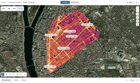
For a focused hosted mapping job, add MapperTool to the shortlist. It processes drone photographs in the cloud and keeps map layers, measurements, 3D review and sharing in one browser workflow.
Product | Where processing runs | How it is sold (checked November 9, 2026) |
|---|---|---|
PIX4Dmapper | On your workstation | Subscription, about USD 3,990 per year billed yearly |
PIX4Dmatic | On your workstation | Analyst, Standard and Pro plans. Standard is about USD 3,990 per year billed yearly |
PIX4Dcloud | Hosted by PIX4D | See the PIX4D pricing page |
DroneDeploy | Hosted platform | Individual plans listed at about USD 1,908 and USD 4,188 per year. Platform plans on request |
DJI Terra | On your workstation | Standard and Flagship editions through DJI dealers |
MapperTool | In the cloud, reviewed in the browser | Depends on the plan, see pricing |
What do the trials let you test?
A trial is only useful if it can process a dataset that looks like your normal work. PIX4D lists a 15 day trial for most of its products. DJI lists a one month trial of Terra on one computer that does not reconstruct more than 500 photos.
A 500 photo limit covers a small site, but it cannot show how a full survey behaves. If your regular jobs are larger, plan the trial around a representative section and decide in advance what that section is meant to prove. For DroneDeploy, check the trial terms on its pricing page for the plan you are considering.
How do you compare one delivery from start to finish?
Use a site with the same kinds of surfaces and image count as your regular work. Keep the original photographs, and check camera metadata, coverage and image detail before processing. A weak input set can make a software change look like the answer to a capture problem. Our photo readiness checklist covers those checks.
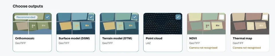
Write down the outputs before you start. An orthomosaic, an elevation raster and a textured model are distinct requirements. Include the coordinate system and the application that will receive each export. The output guide helps decide which layers the recipient really needs.
For the processing step, record whether the required files are produced and what intervention is needed. For review, inspect the difficult geometry, such as roof edges, interrupted surfaces and the project boundary, and make a measurement that matters to the job.
Avoid judging only the most attractive screenshot. The useful comparison includes the time spent preparing inputs, correcting issues and explaining the result to someone else. Keep processing speed separate, because it depends on the dataset, the hardware and the settings.
What should you write down during the test?
A comparison is only as good as its notes. Use the same short record for every candidate, so the decision does not rest on memory or on the last product you tried.
The dataset: site, photo count, camera and whether every image has a GPS position.
The settings you changed from the defaults, and why.
Every manual fix needed before the outputs were acceptable.
The files produced, their formats and where each one was opened.
What the recipient could and could not do without your help.
Score each line as done, done with effort or not possible. A product that needs two manual fixes on every job will cost more time over a season than its price suggests, and a product that cannot produce one required file is out, however good the rest looks.
Why test the export and the recipient separately?
A successful reconstruction does not prove that the client can open the result, or that their application interprets it correctly. Open each export in the receiving software and confirm the units, the location and the geometry.
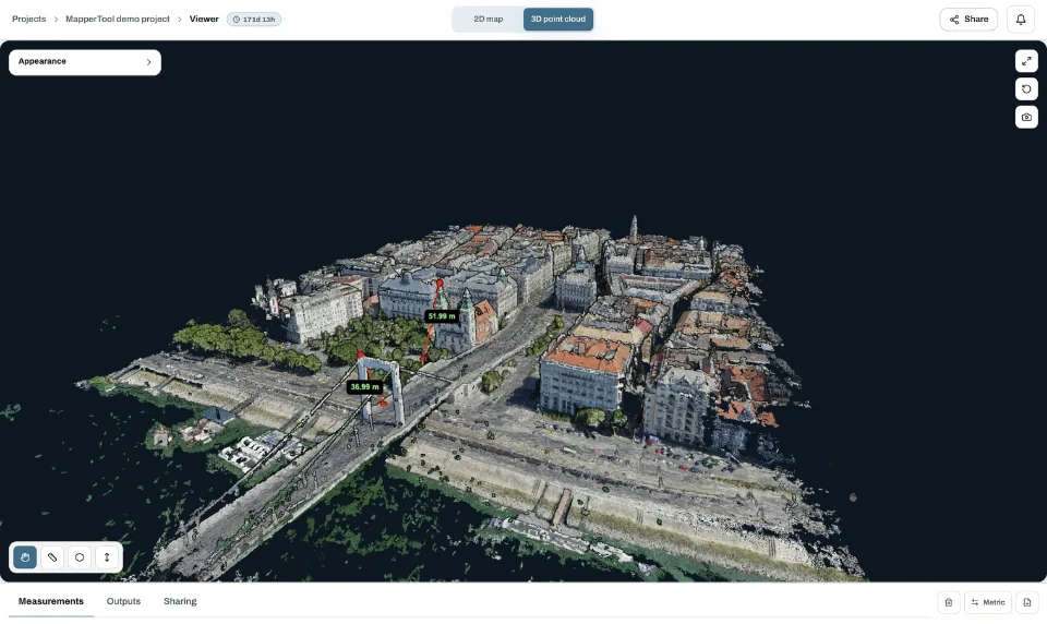
If the review happens online, ask the recipient to find the area and a measurement without your help. In MapperTool a share link opens in the browser without an account, and an email invite puts the project on the recipient's dashboard. The construction deliverables guide lists what a typical site client expects.
When does the wider platform matter?
If the team needs a specific integration, recurring site documentation process or specialised inspection capability, test that requirement explicitly. Do not assume a named feature is included in the lowest advertised plan.
The same applies to sensors. MapperTool processes photographs, not LiDAR data. If your deliverable depends on a LiDAR payload, compare tools that accept that data.
If the immediate requirement is an orthomosaic, elevation data, a point cloud and a convenient client review, a simpler scope can be an advantage. MapperTool lets you evaluate those steps without installing desktop reconstruction software.
Frequently asked questions
Is DJI Terra better than PIX4D?
Neither is better in general. They are sold and licensed differently and accept different inputs. Run the same representative dataset through both, compare the delivered files and count the manual work each one needed.
Is PIX4D desktop or cloud software?
Both exist. PIX4Dmapper and PIX4Dmatic are desktop applications, and PIX4Dcloud is a hosted service. Compare the specific product, not the brand.
Can I try PIX4D or DJI Terra before buying?
PIX4D lists a 15 day trial for most products. DJI lists a one month Terra trial on one computer, limited to 500 photos per reconstruction. Check the current terms before you start.
Does MapperTool process LiDAR data?
No. MapperTool processes drone photographs into orthomosaics, elevation models and point clouds. LiDAR deliverables need a tool that accepts LiDAR data.
The right choice is the product and plan that completes your delivery with the least unnecessary work. Pick one real job, run it through each candidate and keep the notes. Our cloud mapping guide adds a checklist for the hosted options.