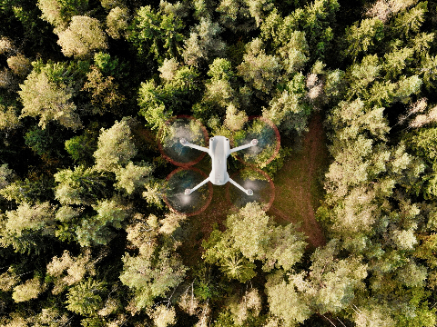
A phone photogrammetry app that works well for a small object can be the wrong tool for a drone survey. An attractive 3D model and a georeferenced site map have different requirements, even when both begin with photographs.
Before choosing photogrammetry software, describe the final result in a sentence. "A model someone can rotate" is a different request from "a map a site manager can measure" or "an elevation surface for another application." That sentence is a useful filter for a crowded software category.
The label 3D mapping software covers all of these, which is why so many comparisons feel unhelpful. The tools share a technique, but they are built for different inputs, outputs and people.
Key takeaways
Start from the deliverable: an object model, a site map or data for another application.
Phone apps are built around close-range capture. Drone mapping tools are built around geotagged image sets of a site.
A realistic model is not automatically a measurement record. Check scale and coordinates.
Decide where processing runs before you compare features.
What does 3D mapping software actually produce?
Photogrammetry finds the same points in overlapping photographs and reconstructs their position in 3D. What happens next depends on the tool. Some turn the result into a textured surface for viewing. Others turn it into maps and elevation data placed in real-world coordinates. If the term is new, our explainer on what 3D mapping software means sets out the basics.
Tool type | Typical input | Typical result | Good fit |
|---|---|---|---|
Phone photogrammetry app | Photos or video taken around an object | Textured 3D model | Objects, small rooms, quick visual records |
Desktop photogrammetry software | Large photo sets on your own computer | Models, point clouds and maps, depending on the product | Users with a capable workstation and time to tune settings |
Cloud drone mapping software | Geotagged drone photographs | Orthomosaic, elevation models, point cloud | Sites that need measuring and sharing |
The table is a starting point rather than a rule. Some desktop products cover both objects and sites, and some apps can process drone photographs. Check the outputs against your sentence, not the category name.
If the result is an object
For a product, sculpture or small structure, the priorities may include the shape, surface texture and file format needed by a design or visualisation application. The capture usually needs views around the object, including the surfaces that matter to the final model.
Check how scale will be established and whether the export is suitable for the next task. A visually realistic model is not automatically a verified measurement record. Our point cloud and mesh comparison explains why those outputs are not interchangeable.
If the result is a site
Drone mapping asks a different set of questions. Where is the surveyed area? Which coordinate system does the recipient use? Is an orthomosaic sufficient, or does the job also need elevation and 3D information? The output guide explains the difference between an orthomosaic, a DSM and a DTM.
MapperTool is designed around this mapping workflow. Suitable photographs become project outputs that you can inspect, measure and share online. A client can review a site in the browser, while a technical recipient can use supported exports on an eligible plan.
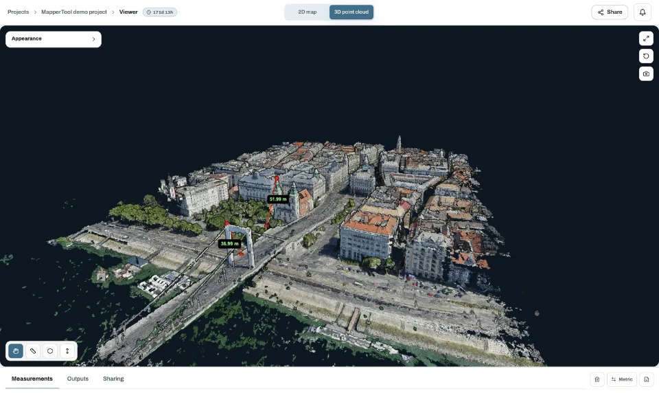
The ability to move between map layers and 3D inspection is useful when one photograph does not explain the site. It lets you keep a visual overview and geometry within the same project discussion.
How do the capture requirements differ?
Object capture is close-range work. You move around the subject, keep the lighting steady and photograph every surface you want in the model. A scale reference, such as a measured bar in the scene, is often the only way the model learns its true size.
Site capture is usually a planned flight over the area. The drone flies a pattern with consistent height and strong overlap between images, and each photograph carries a GPS position. That position is what lets the software place the result on a map, rather than just inside a 3D viewer. Our photo readiness checklist covers the checks to make before processing a drone set.
Mixing the two is possible, but plan it. Adding ground photographs to a drone survey can fill in walls or overhangs, but every image still needs to belong to the same site and meet the input rules of the software you use.
Which five questions settle the choice?
When two tools both look capable, these questions usually decide it faster than a feature list.
What file or view does the recipient need at the end?
Does the result have to sit in real-world coordinates, or only look right?
Will anyone measure on it, and how accurate must that measurement be?
Where should processing run: on a phone, on your workstation or in the cloud?
How will the result reach someone who does not use the same software?
If the answers point to a rotatable model of an object, a phone or desktop tool built for objects is the natural choice. If they point to a measurable map of a place that other people need to open, a drone mapping workflow fits better. If the answers are split, run one small job through each and compare the handover, not the screenshots.
Use the handover to make the choice
Try the intended delivery before committing to a workflow. For an object, open the export in the application that will use it. For a survey, check the map, coordinates, required measurements and client access.
Also decide who will run the processing. An installed tool uses local resources unless it offers a separate hosted service. MapperTool runs reconstruction in the cloud, so you can evaluate a site mapping workflow without maintaining a dedicated processing computer.
Frequently asked questions
What is 3D mapping software?
Software that turns overlapping photographs or scans into 3D data of a place, such as a point cloud, an elevation model or a textured model. For drone surveys it usually also produces a georeferenced orthomosaic.
Can I use a phone photogrammetry app for a drone survey?
Most phone apps are built around close-range capture of objects. Before using one for a site, check that it accepts a drone image set and produces georeferenced maps and elevation data, not only a model to rotate.
Does MapperTool create 3D models of objects?
MapperTool is built for sites. It turns geotagged drone photographs into orthomosaics, elevation models and point clouds that you can inspect, measure and share in the browser.
Do I need a powerful computer for photogrammetry?
Desktop software processes on your own machine, so large datasets need a capable workstation. Cloud tools such as MapperTool run the reconstruction on their servers, and a normal browser is enough to review the result.
There is no need to force every job into one application. Choose the tool that fits the input and the deliverable. For geotagged survey photographs that need to become accessible maps and 3D site data, MapperTool offers a direct route from processing to review.