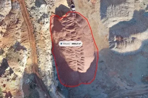
A construction client needs drone survey deliverables that answer a site question. Where can materials be stored? What was visible before work began? Which pile was measured, and what surface was used beneath it? A folder of files is useful only when the recipient can identify the right result and understand what it represents.
For most handovers, prepare three things: an accessible project view, the agreed data files and a short record of the survey and its measurements. MapperTool brings the first two into the same workflow, with browser review, measurement tools and downloadable outputs on an eligible plan. Its project report provides a convenient way to collect selected project information and results into a PDF.
Agree on the decision before choosing the files
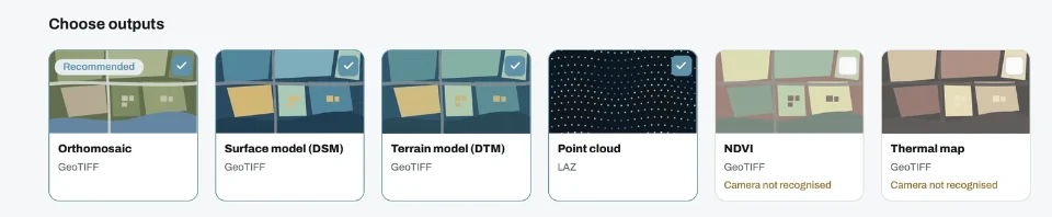
Consider a site manager reviewing a materials yard. The manager may need an orthomosaic map to identify access routes and storage areas. A quantity reviewer may also need a surface model and the assumptions behind a stockpile measurement. A designer could require a point cloud in a specified coordinate system.
These are different deliveries from the same survey. Ask each recipient what they will open, what decision they will make and whether they need to continue working with the data. Record the expected file format, units, coordinate reference system and capture date before processing.
For the differences between the main layers, see our guide to orthomosaics, DSMs and DTMs. Use that choice to keep the package relevant. Extra outputs are helpful when they answer another agreed question, not simply because they are available.
Make every reported quantity traceable
A volume without a boundary or base assumption is difficult to review. Give each measurement a name that the site team recognises, such as the material and yard location. Include the survey date and the reason for choosing its reference surface.
In MapperTool, review the measurement against the visible map and elevation data before including it in the handover. If a pile meets a wall, vegetation obscures an edge or the ground beneath it is uncertain, explain how that affects the result. Our stockpile measurement workflow covers the checks behind the number.
A useful handover note might say that a quantity represents the visible pile within the drawn boundary on the capture date. It should also state the chosen base method. Do not turn a clear looking map into an unsupported claim of certified accuracy.
Give the client a view and an archive
A browser link makes the first review straightforward. The recipient can inspect the site without first installing a GIS application. MapperTool projects can be viewed through a public link without registration. Registering is useful because the project can then be kept in the recipient's account for easier access.
Use the sharing guide to choose access appropriate to the task. Open the link as the intended recipient would before the meeting, and confirm that the expected layers are available.
For the archive, supply the agreed exports and a short file inventory. Keep original survey images separately. A convenient online view and a retained copy serve different needs, especially when a project has a storage deadline.
Keep the PDF focused on the review
The MapperTool project report lets you choose project details, quality information, measurements and available layer images. Select the sections that support the client's decision. A report for a site review does not need every possible layer.
Explain what was captured, what was measured and what still needs checking on site. Finish with the person responsible for the next action. That makes the report useful after the meeting, when someone needs to act on the findings rather than reconstruct the conversation.
Before sending the package, open an exported file in the recipient's intended application and compare it with the browser view. Check the units, site location and capture date. With that final check, MapperTool becomes a practical route from processed imagery to a handover the construction team can use.