You do not need GIS software just to open a drone map or take a few measurements. If your drone mapping software includes a viewer, you can often inspect the results, measure an area and share the survey with a client in the same application.
A GIS becomes useful when you need to do more with the data: combine it with property boundaries, maintain inspection records, calculate areas across many sites or analyse terrain. It gives you more control, but it also takes time to learn and set up.
For most survey jobs, the decision comes down to what happens after processing. The following four examples show where a viewer is usually enough and where additional software becomes useful.
Reviewing a site with a client
A project manager who wants to inspect an access road or discuss construction progress usually needs a clear view of the site. They may want to zoom in, switch between layers or look at a structure in 3D. They do not necessarily need the original survey files on their computer.
This is a straightforward use for a browser viewer. The MapperTool viewer lets you open the project's generated outputs in a 2D map or 3D point cloud view. The client can inspect the results without installing a separate application.
Sharing a link also avoids asking someone to download a large GeoTIFF and work out how to open it. If they only need to review the site, that extra step serves little purpose.
There are still a few details to agree before sending the link. How long will the client need access? Do they need to download anything? Will they only look at the map, or take their own measurements? The guide to sharing a drone map with a client covers these options.
Taking measurements from a survey
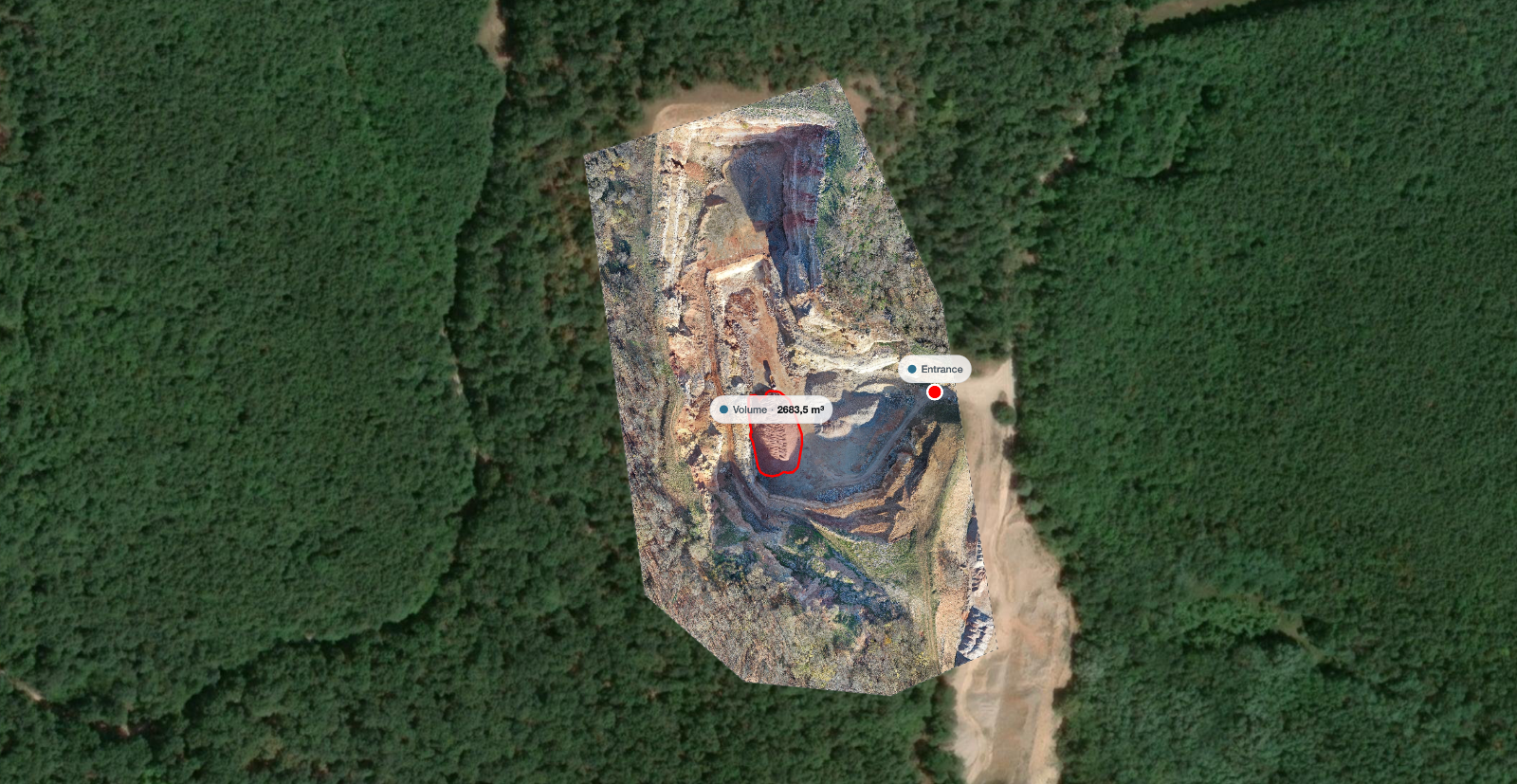
For common measurements, a viewer may provide all the tools you need. You might want the area of a storage yard, the distance between two structures or the height of a material stack. MapperTool includes distance, area, height and volume tools, described in the measurement documentation.
The important part is using the right data for the measurement. An orthomosaic map gives you horizontal distances and areas. To measure height, you need elevation data or a point cloud. To calculate a stockpile volume, you also need to define the surface beneath the pile.
Consider a roof. Tracing its outline on an orthomosaic gives you the area of its horizontal footprint. A pitched roof has a larger surface area, so that measurement alone is not enough to order roofing material. Moving the same image into a GIS would not change what the image contains, you would still need to account for the roof's slope.
For more examples, see measuring area, distance and height on a drone map.
The survey's quality matters whichever application you use. Check that the feature is clearly reconstructed, choose measurement points carefully and report only the precision the data supports. More software does not compensate for missing coverage or an inaccurate reference system.
For a handful of measurements on a single project, there may be no reason to go further. A GIS becomes more useful when those measurements form part of a larger dataset that you need to organise and update.
Keeping asset and inspection records
Suppose you inspect drains across several sites. You need a location for each drain, but also its identifier, condition, inspection date and repair status. On the next visit, you need to update the existing record and find the drains that still require work.
This is the kind of task that GIS software, or a dedicated asset-management system, is designed to support. The map locations and their associated information are stored together, so you can search, filter and update them.
The drone survey provides a useful background. You can use it to locate the drains and understand the surrounding site, while keeping the inspection records in a separate layer. When new imagery becomes available, the records can remain in place rather than having to be recreated on each new survey.
QGIS is a free, open-source option for creating, editing and analysing geographic data. It is worth considering if you need to build this kind of dataset and are prepared to learn the relevant tools.
If several people will edit the records, consider how they will share them. Separate copies of a desktop project can quickly become difficult to maintain. An online GIS or a shared database may suit the team better, depending on the access controls and editing features required.
Before choosing a system, try a small example: add a few drains, record an inspection, update a repair status and export the records. This should reveal whether the everyday work is simple enough for the people who will actually do it.
Combining survey data with other layers
Some questions require more than a measurement on one map. You may need to calculate how much of a site lies within each property boundary, compare a survey with a restriction zone or assess terrain alongside an existing drainage network.
GIS tools let you work with these datasets together. You can define the calculation, apply it across the relevant features and save the results for further analysis or reporting.
Before doing so, check that the layers are suitable for comparison. They may use different coordinate systems, represent different dates or have very different levels of detail. Elevation data also needs a consistent height reference.
Choose the elevation model carefully. A DSM includes the tops of buildings and vegetation, while a DTM represents the ground. For an explanation of the differences, see orthomosaic, DSM and DTM: which one do you need?.
Engineering design may require another application as well. If the deliverable includes proposed road geometry, grading or construction drawings, CAD or civil-design software may be needed. MapperTool processes photographs and provides tools for viewing and measuring the results.
Using MapperTool alongside a GIS
You can use both without making the client use both. Process the photographs and review the survey in MapperTool, export the required outputs for further work, and share a browser link with anyone who only needs to inspect the result.
Before relying on that arrangement, confirm that your plan includes the required downloads and that the recipient's software supports the files. Include the capture date, coordinate system, units and any relevant accuracy information when you hand them over.
If you are unsure whether you need a GIS, start with one of your usual jobs. Try completing it in the viewer. If you can take the required measurements and deliver what the client needs, there is no immediate reason to add another application. If you need to maintain records or analyse several datasets together, you have a clear reason to explore a GIS.
Upload your drone photos to MapperTool to process a survey and inspect the results in the browser.