The cost of a drone survey depends on the information the job must deliver, not simply the area of the site or the number of points in the file. Access, visible surfaces, required confidence and the work after capture can change the scope substantially.
That is why two quotes for the same site can differ by a wide margin and both be honest. One may include accuracy checks, a cleaned point cloud and a review link for the client. The other may cover a flight and a raw orthomosaic.
This guide sets out what moves the price, what a written quote should state and how to compare offers on equal terms. It works from both sides: for the client buying a survey and for the operator writing the quote.
Key takeaways
There is no reliable single price per acre. Scope, access and accuracy evidence move the cost more than area alone.
Compare quotes only after both describe the same coverage, outputs, checks and delivery.
Accuracy needs evidence, such as surveyed check points. A larger point count is not proof.
Keep software, fieldwork and professional review as separate lines, so the quote shows where the time goes.
Why is there no single price per acre?
Price per acre is a convenient headline, and some providers publish ranges. It hides the parts of the job that take the most time: getting access, capturing the difficult surfaces, checking the result and turning it into the files the client actually uses.
A flat open field and a busy construction site of the same size are different jobs. So are a quick visual orthomosaic and a point cloud that will be used to check clearances. Start from the deliverable, then let the area adjust the estimate.
What drives the cost of a drone survey?
Cost driver | What changes the price | What to ask |
|---|---|---|
Site and access | Size, shape, permissions, restricted hours, travel | Which parts of the site are included or excluded? |
Surfaces to capture | Open ground, facades, structures, terrain under vegetation | Which surfaces must be visible in the result? |
Accuracy evidence | Control and check points, independent verification | How will the stated accuracy be checked and reported? |
Deliverables | Orthomosaic, DSM or DTM, point cloud, drawings, classification | Which files, formats and coordinate system are included? |
Review and delivery | Processing, quality review, client access, archive | Who reviews the result, and how long will it stay available? |
Each line is a decision, not a fixed cost. A quote becomes easier to compare when every line is answered in writing.
How does accuracy change the quote?
If the job only needs a visual record, the capture can be simple. If the result will be used for measurements that others rely on, the quote should explain how accuracy is checked, for example with surveyed check points that are not used in processing. That fieldwork and the report that goes with it are real costs.
Ask what accuracy evidence the intended use requires, and make sure it appears in the quote. A larger point count is not an independent verification of accuracy. Our guide to drone survey accuracy explains the difference between resolution and accuracy.
What should a written quote state?
A good quote reads like a scope list. You should be able to hand it to a second supplier and receive a comparable price.
The surveyed area on a map, with any exclusions.
The capture method and the surfaces that must be visible.
The deliverables, with file formats and the coordinate system.
How accuracy will be checked and reported.
The delivery date, the review route for the client and how long results stay available.
How extra visits or changes in scope are handled and priced.
Our construction deliverables guide lists the outputs a typical site client expects, and the point cloud format guide explains why the file format should be agreed early.
How do operators keep their own costs predictable?
If you write quotes, the same structure protects your margin. Record fieldwork, processing, review and delivery as separate lines, even if the client sees one total. After a few jobs you will know which lines grow on difficult sites.
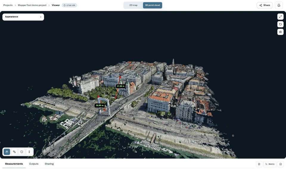
For suitable photographic surveys, MapperTool provides cloud reconstruction and browser review. That can simplify the software part of the workflow: process the images, inspect the output, take relevant measurements and share the result with the client, without a dedicated processing computer. Plan capacity and retention depend on your plan, see pricing.
The software does not remove the need to plan the capture or verify the result. Keeping it as its own line avoids confusing a subscription price with a complete survey fee. If you are weighing whether a job justifies a drone at all, see is drone photogrammetry worth it.
How should you budget for repeat surveys?
Many sites need more than one visit: monthly progress on a construction job, quarterly stockpile volumes or a before and after record. Repeat work changes the economics, and the quote should reflect it.
The first visit carries most of the setup: access arrangements, control points and agreeing the deliverables.
Later visits can reuse the same flight plan, settings and report layout, so they usually take less time.
Comparisons between visits only work if capture conditions and processing settings stay consistent.
Results from earlier visits need to stay available, so agree how long each survey is kept and how the client reaches it.
Ask for the first visit and the repeat visits as separate lines. A supplier who prices every visit the same is either including setup work you will not need again or leaving it out of the first quote. Either way, the difference is worth asking about before the contract starts.
Frequently asked questions
How much does a drone survey cost?
It depends on the area, access, the surfaces to capture, the deliverables and the accuracy evidence required. Published per-acre ranges are a starting point at best. Ask for a written scope and compare quotes against the same scope.
Why do drone survey quotes vary so much?
Because they rarely describe the same work. One may include check points, a cleaned point cloud and client access, while another covers a flight and a raw map.
Is a point cloud survey more expensive than an orthomosaic?
Often, because walls, structures and detailed 3D surfaces need more capture and more review. A simple point cloud from the same flight as the orthomosaic may add little.
Does the software make up most of the price?
For many jobs, fieldwork and review take more time than processing. Record software separately so the quote shows where the time and money go.
The best priced survey is the one that supplies the agreed information at the required level of confidence, with no important task left undefined. Write the scope first, then compare prices.