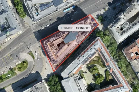
Drone photogrammetry is worth considering for a small job when one capture can answer several useful questions or provide a record that people will revisit. The size of the site alone does not decide its value. A small yard that needs a map, measurements and a shared record may justify more work than a large field that only needs one overview photograph.
Start with the result. If a few ordinary photos fully answer the client's question, reconstruction may add little. If the team needs to inspect positions across the site, measure visible features or review a 3D surface, photogrammetry mapping can provide information that separate photos do not organise as conveniently.
Write down what someone will actually use
Imagine a contractor preparing work in a compact storage yard. There are three possible requests: document the existing condition, measure a visible storage area and let a colleague review the layout remotely. An orthomosaic and browser measurements could support all three.
This is an illustrative decision, not a measured savings claim. The value depends on whether those outputs change how the job is prepared or reviewed. If no one needs a map after the initial conversation, a different form of documentation may be enough.
MapperTool makes a small trial practical because the reconstruction runs in the cloud. You can inspect the resulting map without setting up a processing workstation. The measurement guide shows the kinds of questions you can explore in the viewer.
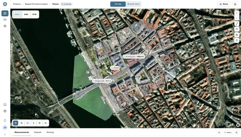
Count the work around the processing
Include preparation, travel, capture, upload, result checks and delivery when assessing the effort. Record hands on work separately from time spent waiting for a computer or network. That distinction makes it easier to see whether cloud processing fits around the rest of the day.
Also consider what happens when a question changes. A useful map may let you revisit a visible area without returning simply to take another photograph. It cannot reveal a covered surface or reconstruct an area that was never captured. The potential benefit is access to existing observations, not unlimited information about the site.
For a first job, note which measurements you actually used and which outputs nobody opened. That record is more useful for the next decision than an assumed percentage saving.
Use a small project to test the whole delivery
MapperTool offers a Free plan for evaluating the workflow with a suitable dataset. Check the current plan details for image capacity, storage, processing settings and download access. Choose a paid plan when the delivery needs its capacity or features.
Process the outputs that answer the question, inspect the reconstruction and try a relevant measurement. Then send the project to the intended recipient. Public viewing without registration makes that first review easy. If the recipient should keep the project, invite their email address so it appears on their dashboard.
Include an export test if the job requires files for another application. Seeing a result online and completing a contractual delivery are different milestones.
When the answer is yes
Photogrammetry is a strong candidate when suitable imagery is available, the required surfaces are visible and a map or 3D record will support real decisions. It becomes more useful when several people need to inspect the same site information.
Pause when the proposed result cannot answer the question, when essential geometry is hidden or when the job requires an independently verified tolerance you have not established. Define that requirement before committing to the method.
MapperTool provides a straightforward way to test the useful part of the workflow: turn the photographs into maps, inspect the results and share them. For a small job, that concrete test is the best starting point for deciding whether to make photogrammetry part of your regular work.