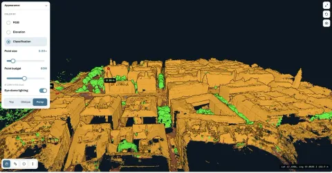
LiDAR is not automatically better than drone photogrammetry. The useful comparison starts with the surface you need to capture. A visible materials yard, a wooded hillside and a building facade present different problems, even if the final deliverable is called a point cloud.
Photogrammetry reconstructs geometry from overlapping photographs. LiDAR measures ranges with laser pulses and combines them with the sensor's position and orientation. Both can produce a point cloud, but the points come from different observations. A file extension alone will not tell you whether either dataset fits your job.
Where aerial photogrammetry software makes sense
On an exposed site, photographs can provide both geometric information and a useful visual record. Roads, roofs, bare ground and material stockpiles are often easier to discuss when the client can recognise their appearance in an orthomosaic.
MapperTool makes that image workflow accessible without a dedicated processing workstation. Upload suitable survey photographs, select the required outputs and review the processed map and 3D data in the browser. The same project can support a visual discussion, measurements and an export for another application.
This is particularly useful when the deliverable includes an orthomosaic as well as geometry. You can inspect the map and point cloud together instead of treating the photograph as a separate illustration. Our photogrammetry guide explains how the reconstruction works.
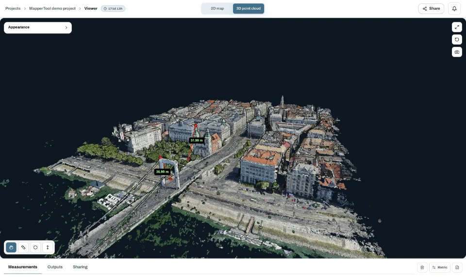
The image shows a photogrammetry workflow in MapperTool. It is not a matched accuracy comparison against a LiDAR survey.
When vegetation changes the choice
If you need the ground beneath trees, visible canopy detail is not enough. Photographs cannot reconstruct a surface that they never see. A smooth terrain model beneath dense vegetation may contain interpolation rather than observations of the ground.
LiDAR can obtain ground returns through openings in vegetation, which can make it more suitable for terrain work. It still needs a path to the surface. Dense cover can prevent adequate returns, and filtering must distinguish ground from objects above it. The NOAA explanation of elevation survey methods describes this distinction.
Ask the supplier for evidence of ground coverage in the part of the site that matters. A high total point count does not answer that question. Our terrain model guide explains why removing vegetation labels does not create missing ground measurements.
Compare complete jobs, not sensor labels
For an open stockyard, compare the quality of the visible surface, the pile boundary and the reference beneath it. For wooded terrain, compare actual ground observations and the resulting gaps. For a facade, check whether the capture sees the required walls and edges from suitable angles.
Then compare the complete delivery: capture, processing, review, usable files and access for the people who need them. Include the hardware and staff effort required for each approach. A cheaper capture that misses the required surface is not a cheaper solution to the job.
Accuracy also needs its own evidence. Neither a laser scanner nor a detailed photograph guarantees a particular result. State the intended use and check the dataset against suitable independent references before accepting a tolerance.
Choose the workflow you can deliver
If the surfaces are visible and your client needs maps, measurements and an accessible site view, drone photogrammetry with MapperTool is a practical starting point. You can inspect a real dataset and test the delivery before committing to a larger workload.
If the job depends on terrain hidden beneath vegetation or another specialised capture requirement, assess the survey method first. This article describes MapperTool's photograph processing workflow and does not assume that external LiDAR files can be uploaded for processing.
The best choice is the method that observes the required surface and produces a result your team can verify. Keep that requirement in front of the software comparison, and the decision becomes much more concrete.