If your client needs to work with a point cloud map, LAZ is usually a practical file to send, provided their software supports it. It stores the cloud in a compressed form without discarding points. If the client only needs to inspect the site and discuss a few measurements, a browser view may be more useful than a large download.
MapperTool supports both routes: you can download the point cloud as LAZ or open it in the browser and share the project. Choosing between them starts with what the recipient wants to do next.
LAS and LAZ: what is the difference?
LAS is a binary format for point cloud data. It stores coordinates and can carry attributes such as colour and classification. LAZ is its compressed counterpart.
The important detail is that LAZ compression is lossless. Compressing a LAS file with LASzip does not thin the cloud or reduce its coordinate precision. Decompression can restore the original LAS data, as described in the LASzip documentation. File size savings vary with the dataset, so there is no single reduction ratio to promise every client.
Question | LAS | LAZ |
|---|---|---|
Does it store individual 3D points? | Yes | Yes |
Is the point data compressed? | No | Yes, losslessly |
Is one inherently more accurate? | No | No |
Which is generally smaller to transfer? | Usually the larger file | Usually the smaller file |
When would you choose it? | A receiving workflow requires LAS | The recipient supports LAZ and wants a compact delivery |
Changing between LAS and LAZ is different from reducing point density. Subsampling removes points, while pure lossless compression preserves them. A conversion that also filters points, changes coordinates or drops attributes is doing more than compression, so inspect its settings before treating it as an equivalent copy.
What does MapperTool export?
MapperTool's point cloud output is LAZ. You can inspect the cloud in the platform before downloading it, which is useful for checking whether the requested area and important surfaces are present.
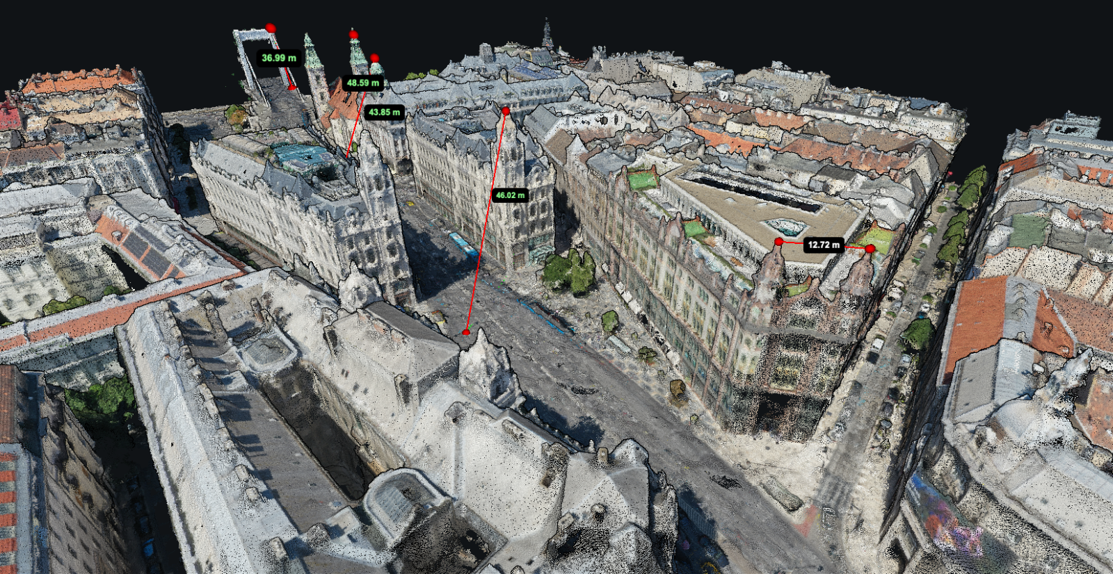
The browser viewer offers photo colours, elevation colours and classification colours, along with distance, area and height measurements. You can also adjust the number of points drawn on screen to balance detail and performance. These controls are described in the point cloud viewer guide.
How can the client open a LAZ file?
They need software that supports point clouds and the supplied file's version and attributes. For example, QGIS documents support for LAS and LAZ in its point cloud guide. Loading a large cloud may involve indexing or other preparation, so the first open can take longer than expected.
For a CAD or specialist survey workflow, ask for the application name, version and accepted import format before delivery.
If their workflow accepts LAS but not LAZ, decompress a copy with a compatible converter. Keep the original LAZ as well, and check that the converted file contains the expected points, colours and other required attributes. Renaming the extension from .laz to .las does not convert it.
For a substantial project, sending a small agreed sample before the final handover can reveal compatibility issues while they are still easy to resolve.
When should you send a browser link instead?
A project manager checking a roof edge or a client reviewing progress may not need to import the survey into 3D mapping software. In that case, sharing the MapperTool project lets them explore the point cloud in the browser.
Recipients can view a shared MapperTool project without registering. Creating a free account is still useful, it saves the shared project to their account, making it easy to find and revisit later.
A link and a file can also serve different people on the same job. The designer receives the LAZ for further work, while the project manager receives access to the browser view. Our guide to sharing a drone map with a client covers the handover in more detail.
What information should accompany the file?
A correctly opened point cloud can still be used incorrectly if its coordinate reference is unclear. Include a short delivery note with the survey date, area covered, horizontal coordinate system, height reference, units and any processing or accuracy limitations relevant to the work.
Ask which attributes the recipient needs. If they expect ground classifications or colour, check those are actually present rather than assuming the file extension guarantees them. Our point cloud classification guide explains what those labels mean.
Finally, confirm that they asked for a point cloud. A mesh is a different representation, and a list of points does not become a continuous surface simply because it opens in 3D. For that distinction, see point cloud or 3D mesh.
For your next MapperTool delivery, inspect the cloud first, ask what the client needs to do with it, and provide the LAZ, shared project or both. That small conversation prevents a familiar problem, a complete survey arriving in a form the recipient cannot use.