Ask five people what a digital surface model is and you will get five answers, most of them starting with the word terrain. That single word is where the confusion begins, because terrain is exactly what a DSM is not.
A DSM is the elevation of the top of everything. Roofs, tree canopies, parked machinery, the crane that happened to be on site that morning. Whatever the camera could see from above, the DSM records the height of that, and not the ground underneath it.
That definition sounds pedantic until someone plans a driveway from one.
Key takeaways
A DSM stores one elevation value per pixel, for the topmost surface at that position.
It is measured, not interpreted, which is what makes it the more trustworthy of the two elevation models.
Free global elevation data is genuinely useful, and its pixels are usually tens of metres across.
The colours you see are a display choice. The file itself is a grid of numbers in metres.
What a DSM actually contains
A DSM is a single band raster. Where an orthomosaic holds three colour channels per pixel, a DSM holds one number, and that number is an elevation. Nothing else is in the file.
This is why a DSM opened in an ordinary image viewer looks like a washed out grey mess. The viewer is trying to interpret elevation values as brightness. Open the same file in a GIS or in a proper viewer and a colour ramp gets applied to the range of values, which is where the familiar blue to red elevation map comes from. The colours are not in the data. They are a decision made at display time, and two people can look at the same DSM and see completely different pictures depending on how their software stretched the range.
The pixel size matters as much as the values. A DSM at 5 cm per pixel and a DSM at 30 m per pixel are the same kind of file describing utterly different realities, and most of the disappointment people have with elevation data comes from this one number.
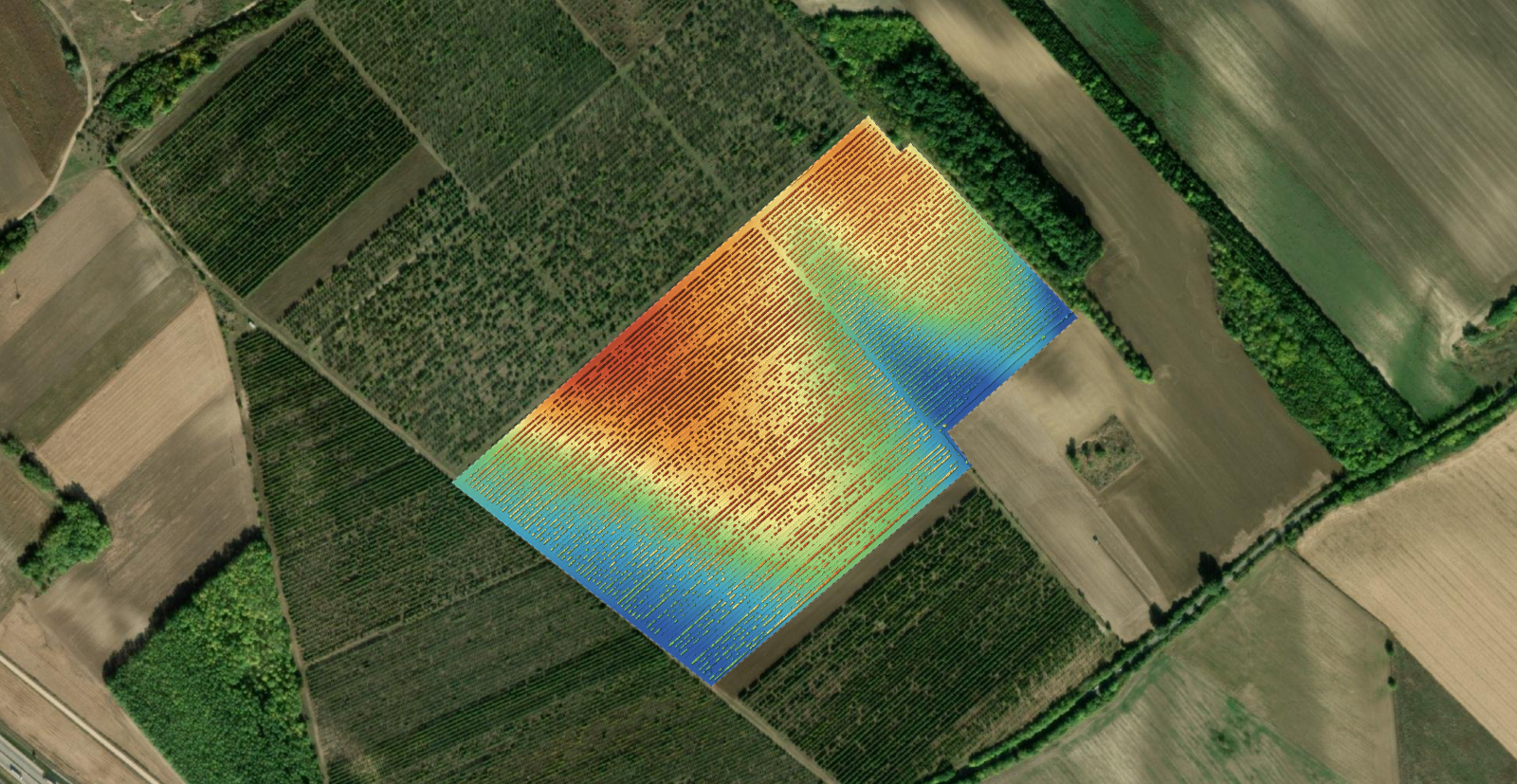
How a DSM is built from photographs
Photogrammetry reconstructs a dense cloud of 3D points from overlapping images. The DSM is that cloud viewed from directly above and rasterised: the survey area is divided into a grid, and each cell takes the elevation of the highest points that landed in it.
Two consequences follow, and both are worth knowing before you rely on the file.
The first is that a DSM is measured rather than derived. Every value came from points the software actually reconstructed. That is a meaningfully different status from a terrain model, where the ground under a building has to be estimated because nothing ever saw it. The difference between the two is the subject of orthomosaic vs. DSM vs. DTM.
The second is that the DSM inherits every weakness of the reconstruction. Where the point cloud is thin, the surface is interpolated across the gap and looks perfectly smooth while being invented. Water, glass, fresh snow and uniform gravel are the usual suspects, and none of them announce themselves in the finished raster.
What you can actually do with one
Task | Does a DSM answer it |
|---|---|
How tall is that building or stack | Yes, sample the top and a point on the ground beside it |
Will this antenna have line of sight | Yes, and this is a DSM job specifically, since trees and roofs block signals |
How much material is in that pile | Partly, you need a base surface underneath it as well |
Where will water pond after rain | No, use a terrain model, the roofs will corrupt the flow |
How thick is the tree canopy here | Yes, if you also have a terrain model to subtract |
How steep is this slope | Yes on open ground, no under vegetation |
The pattern is that anything about the top of the world is a DSM question, and anything about the ground is not.
Free elevation data, and where it stops being enough
Most people searching for a digital surface model are not looking for software. They want elevation data for an area, and there is a lot of it available at no cost.
Global open datasets cover almost the entire land surface, and their pixels are typically in the tens of metres. That is genuinely useful for catchment analysis, for regional line of sight, for a first look at a landscape and for anything where the shape of a hillside matters more than the shape of a building. Some countries also publish national lidar derived models at a metre or better, and where those exist they are usually the best free data you will find. Coverage, vintage and licensing all vary, so check the provider before building anything on top of it.
Where free data stops working is when the thing you need to measure is smaller than one pixel. A 30 m pixel cannot see a stockpile, a roof ridge, a drainage ditch or a kerb line, and no amount of processing recovers detail that was never sampled. The other limit is time: open datasets are snapshots from a particular year, and a site that changes monthly is not described by one.
Make a DSM of your own site
Upload overlapping drone photos and pick the outputs you need. The free plan takes up to 150 photos per project.
Upload drone photosWhere a DSM is wrong, and how to spot it
A DSM never tells you which of its values it is confident about, so the checking is on you. Four places are worth a look on every project before the file goes anywhere.
Water. Lakes, ponds and wet asphalt reconstruct badly, and the result is either noise or a smooth invented surface at the wrong height. Neither looks suspicious in a colour ramp.
Under and around vegetation. The canopy top is real. Anything the canopy hides is not present in the file at all, and where the software had to bridge a gap it did so by interpolation.
Thin vertical structures. Poles, masts and crane jibs are narrow relative to the pixel and tall relative to everything around them. They tend to smear, lean or partially disappear.
The outer edge of the flight. Cells near the boundary were seen by fewer photos from fewer angles, so both position and elevation are least reliable exactly where people like to measure boundaries. Fly a buffer past the area of interest.
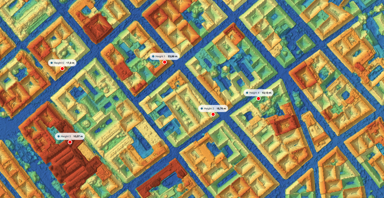
Getting a DSM from your own flight
The flight decides the result, and the processing only reveals it. Fly with enough overlap for the reconstruction to be well constrained, keep the height consistent relative to the ground rather than to the take off point on sloped sites, and fly a buffer past the edges. The arithmetic linking flight height, overlap and photo count is in how many photos does a drone map need.
At processing time you choose which outputs you want, and the DSM is one of them. Ask for the terrain model at the same time if you will need both, because volume and drainage work needs the pair rather than either one alone.
One number to agree before you start rather than after: the coordinate reference system, horizontal and vertical. Elevations tied to an ellipsoid and elevations tied to a national height datum can differ by tens of metres for the same point, and that difference is silent until someone compares your figures against a levelled benchmark. What accuracy means in its three separate senses is set out in drone survey accuracy explained.
Frequently asked questions
Is a DEM the same thing as a DSM?
Digital elevation model is the umbrella term, and in everyday use most people mean bare ground when they say it. Because the word is ambiguous, name the file DSM or DTM explicitly in any delivery and state in one line which one it is.
Why does my DSM open as a grey mess?
Because an ordinary image viewer is reading elevation values as brightness. Open it in a GIS or a viewer that applies a colour ramp to the value range, and the terrain appears. The file is not broken, it simply is not a picture.
Can I get a DSM without flying, from free data?
Yes, and for regional work it may be all you need. The constraint is pixel size and age. If your smallest feature of interest is smaller than a couple of pixels of the free data, or the site has changed since it was captured, you need your own flight.
How accurate are the elevations in a DSM?
Vertical error in photogrammetry is typically larger than horizontal, and both depend on flight height, overlap and how the survey was georeferenced rather than on the DSM itself. Sample any critical height in several places and look at the spread rather than trusting a single click.
Before you request an elevation model for anything, ask one question: does this job care about the top of the world or the ground underneath it. Line of sight, canopy, roof heights and obstruction work all want the surface model. Drainage, earthworks and cut and fill do not, and reaching for the wrong one is how a set of perfectly good numbers ends up describing the wrong thing.